

Geography and Map
Kalpetta Block Panchayat is located in Vythiri Taluk of Wayanad District and encompasses a diverse geographical landscape consisting of the scenic mountain ranges of the Western Ghats, lush green valleys, agricultural lands, forest areas and abundant water resources. The region is characterised by its natural wealth, rich agricultural heritage and tourism potential.
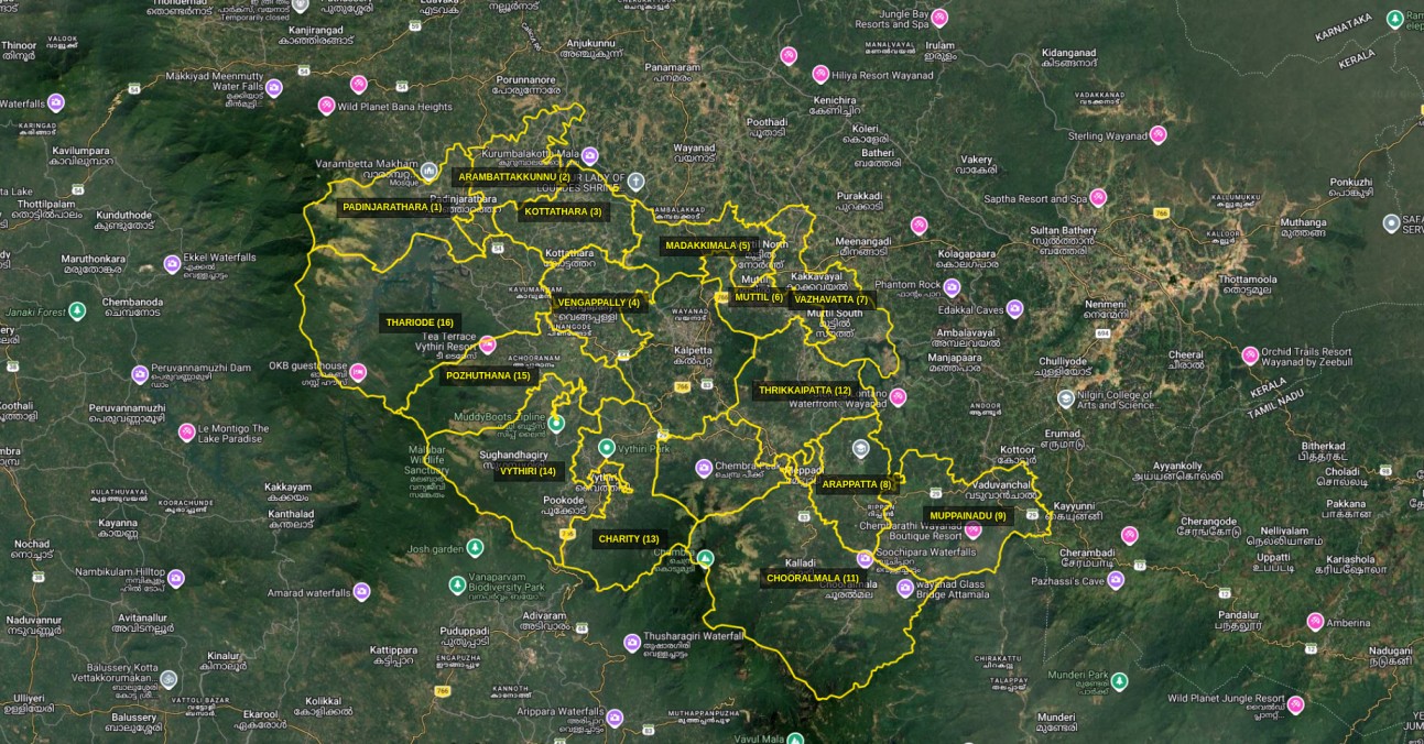
📌 Location
Kalpetta Block Panchayat is situated in Vythiri Taluk, in the western part of Wayanad District.
🏢 Headquarters
Kalpetta is the headquarters of the Block Panchayat.
West
Kozhikode District, including Vadakara, Koyilandy and Kozhikode Taluks.
North
Mananthavady Block Panchayat.
East
Sulthan Bathery Block Panchayat and Nilgiris District.
South
Nilambur and Koduvally Block Panchayats.
Mountain Ranges
The mountain ranges and hilly regions forming part of the Western Ghats give the Block Panchayat its distinctive geographical character.
Valleys & Water Resources
Valleys, streams and small watercourses between the mountain ranges contribute to the region's water resources and support agricultural activities.
Forest Areas
Forests, natural vegetation and rich biodiversity form an important part of the natural resources of the region.
Agricultural Lands
Agricultural lands spread across the slopes and valleys play an important role in the local economy and livelihoods.
The geographical characteristics of Kalpetta Block Panchayat have a direct influence on the lifestyle and livelihood patterns of its people. The combination of mountains, valleys, agricultural lands and forest areas creates diverse conditions that support agricultural activities and allied livelihood sectors.
Agriculture
Water Resources
Forest Resources
Tourism
The geographical identity of Kalpetta Block Panchayat is defined by the harmonious combination of natural mountain ranges, lush valleys, forest resources, agricultural lands, water resources and tourism potential. Conservation and sustainable utilisation of these natural resources are crucial for the future development of the region.


